Urn and Willow Publishing

Lakeville and Middleborough, Massachusetts Historical and Genealogical Materials

Home
Shipping
Return Policy
Mail Order Form
Lakeville Historical Society and Museum

Purchase Locally

Contact us at: info@urnandwillow.com


1879 
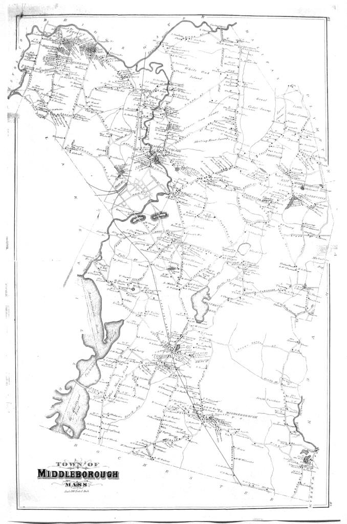
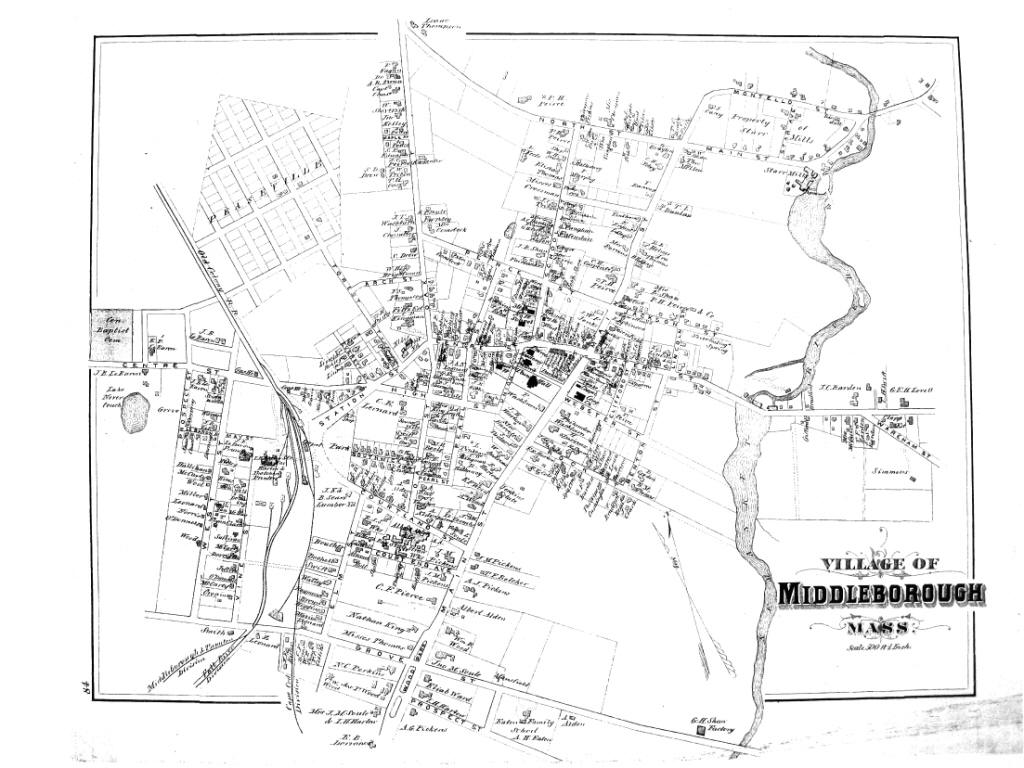
Maps of Middleborough, Massachusetts (2 maps)
$28.95

These black and white maps are new prints reproduced from the original set of maps that were part of the Atlas of Plymouth County published in 1879 by the George H. Walker, Co., Boston, Massachusetts. Shading present in the photographs is due to lighting and is not present in the maps you will receive.

These maps are printed from pages 82, 83, and 84 of that Atlas.

Page 82-83 are joined and measure approximately 17" x 27". Page 84 measures approximately 14" x 17".

The map of the town (page 82-83) shows ponds, railroads, schools, roads, swamps, cemeteries, churches, mills present in 1879. Buildings are shown with a black square, and homes are identified with the surname and first initial of the homeowner.

Page 84 shows details of the "Village of Middleborough." The town hall, railroad tracks, businesses, cemeteries, parks, schools, churches, and factories are indicated on the map. Also shown are not only the locations but also the shapes of the buildings with the owners name indicated.

This is a great resource for historical or genealogical research!